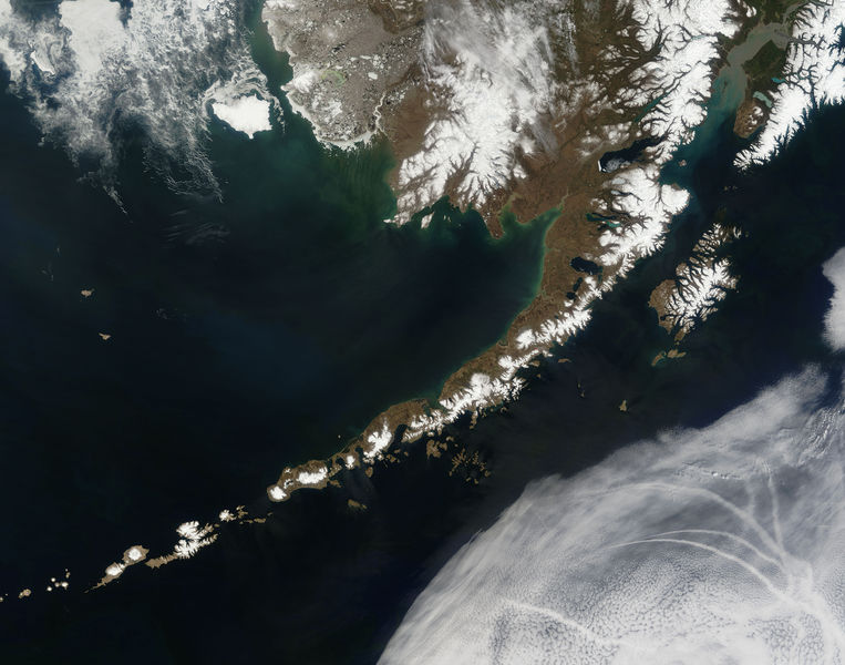
Fayl:150132main image feature 589 alaska.jpg

Bu prevyuning hajmi: 763 × 600 piksel. Boshqa oʻlchamlari: 306 × 240 piksel | 611 × 480 piksel | 978 × 768 piksel | 1 280 × 1 006 piksel | 2 560 × 2 011 piksel | 5 600 × 4 400 piksel.
Asl fayl (5 600 × 4 400 piksel, fayl hajmi: 6,63 MB, MIME tipi: image/jpeg)
Fayl tarixi
Faylning biror paytdagi holatini koʻrish uchun tegishli sana/vaqtga bosingiz.
| Sana/Vaqt | Miniatura | Oʻlchamlari | Foydalanuvchi | Izoh | |
|---|---|---|---|---|---|
| joriy | 19:55, 2006-yil 14-iyul |  | 5 600 × 4 400 (6,63 MB) | Felipe Menegaz | {{Information| |Description= The Aleutian Islands and the Alaskan peninsula are shown in this image acquired by the MODIS on the Terra satellite, on May 25th, 2006. The Aleutians are a chain of more than 300 small volcanic islands forming an island arc in |
Fayllarga ishoratlar
Bu faylga bogʻlangan sahifalar yoʻq.
Faylning global foydalanilishi
Ushbu fayl quyidagi vikilarda ishlatilyapti:
- af.wikipedia.org loyihasida foydalanilishi
- als.wikipedia.org loyihasida foydalanilishi
- bn.wikipedia.org loyihasida foydalanilishi
- ca.wikipedia.org loyihasida foydalanilishi
- cs.wikipedia.org loyihasida foydalanilishi
- de.wikipedia.org loyihasida foydalanilishi
- eo.wikipedia.org loyihasida foydalanilishi
- es.wikipedia.org loyihasida foydalanilishi
- fr.wikipedia.org loyihasida foydalanilishi
- gl.wikipedia.org loyihasida foydalanilishi
- hu.wikipedia.org loyihasida foydalanilishi
- ia.wikipedia.org loyihasida foydalanilishi
- it.wikipedia.org loyihasida foydalanilishi
- ja.wikipedia.org loyihasida foydalanilishi
- ko.wikipedia.org loyihasida foydalanilishi
- oc.wikipedia.org loyihasida foydalanilishi
- os.wikipedia.org loyihasida foydalanilishi
- pl.wikipedia.org loyihasida foydalanilishi
- pl.wiktionary.org loyihasida foydalanilishi
- pt.wikipedia.org loyihasida foydalanilishi
- ro.wikipedia.org loyihasida foydalanilishi
- ru.wikipedia.org loyihasida foydalanilishi
- ru.wikinews.org loyihasida foydalanilishi
- sah.wikipedia.org loyihasida foydalanilishi
- sk.wikipedia.org loyihasida foydalanilishi
- sr.wikipedia.org loyihasida foydalanilishi
- sv.wikipedia.org loyihasida foydalanilishi
- tr.wikipedia.org loyihasida foydalanilishi


