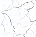
Fayl:Administrative map of the Ermera district of East Timor.png

Bu prevyuning hajmi: 589 × 600 piksel. Boshqa oʻlchamlari: 236 × 240 piksel | 471 × 480 piksel | 754 × 768 piksel | 1 006 × 1 024 piksel | 1 381 × 1 406 piksel.
Asl fayl (1 381 × 1 406 piksel, fayl hajmi: 331 KB, MIME tipi: image/png)
Fayl tarixi
Faylning biror paytdagi holatini koʻrish uchun tegishli sana/vaqtga bosingiz.
| Sana/Vaqt | Miniatura | Oʻlchamlari | Foydalanuvchi | Izoh | |
|---|---|---|---|---|---|
| joriy | 06:08, 2009-yil 19-sentyabr |  | 1 381 × 1 406 (331 KB) | Chumwa | {{Information |Description= {{ de }} Verwaltungskarte des Distrikts Ermera in Osttimor {{ en }} Administrative map of the Ermera district of East Timor |Source=Self made, using informations from the[http://websig.civil.ist.utl.pt/timorgis Timor-Leste GIS |
Fayllarga ishoratlar
Bu faylga bogʻlangan sahifalar yoʻq.