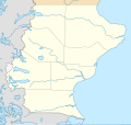
Fayl:Argentina Santa Cruz location map.svg

Size of this PNG preview of this SVG file: 493 × 600 piksel. Boshqa oʻlchamlari: 197 × 240 piksel | 394 × 480 piksel | 631 × 768 piksel | 842 × 1 024 piksel | 1 683 × 2 048 piksel | 900 × 1 095 piksel.
Asl fayl (SVG fayl, asl oʻlchamlari 900 × 1 095 piksel, fayl hajmi: 380 KB)
Fayl tarixi
Faylning biror paytdagi holatini koʻrish uchun tegishli sana/vaqtga bosingiz.
| Sana/Vaqt | Miniatura | Oʻlchamlari | Foydalanuvchi | Izoh | |
|---|---|---|---|---|---|
| joriy | 00:56, 2022-yil 29-dekabr |  | 900 × 1 095 (380 KB) | Janitoalevic | Precise borders |
| 20:25, 2022-yil 23-noyabr |  | 900 × 1 095 (257 KB) | GrandEscogriffe | more correct north-south stretching | |
| 23:39, 2017-yil 15-oktyabr |  | 900 × 850 (267 KB) | Janitoalevic | More precise borders. | |
| 11:41, 2017-yil 10-sentyabr |  | 900 × 850 (256 KB) | Milenioscuro | capas | |
| 22:00, 2016-yil 30-aprel |  | 900 × 850 (316 KB) | Janitoalevic | Fixed some parts of the coast line and added border in Lake San Martín/O'Higgins | |
| 00:05, 2016-yil 16-aprel |  | 900 × 850 (317 KB) | Janitoalevic | Fixed Details | |
| 20:23, 2016-yil 15-aprel |  | 900 × 850 (317 KB) | Janitoalevic | Fixed Lakes, Coast lines, International and Internal Borders, Added Disputed Area. | |
| 08:35, 2016-yil 12-mart |  | 900 × 850 (414 KB) | Milenioscuro | Updated borders File:Tierra del Fuego location map.svg, File:Mapa loc Magallanes.svg | |
| 14:59, 2013-yil 14-iyul |  | 900 × 850 (602 KB) | Milenioscuro | == {{int:filedesc}} == {{Information |Description={{de|Positionskarte von Santa Cruz (Argentinien)}}{{en|Location map of Santa Cruz province (Argentina)}}{{es|1=Mapa de localización de la Provincia de Santa Cruz.}... |
Fayllarga ishoratlar
Bu faylga quyidagi 2 sahifalar bogʻlangan:
Faylning global foydalanilishi
Ushbu fayl quyidagi vikilarda ishlatilyapti:
- ar.wikipedia.org loyihasida foydalanilishi
- br.wikipedia.org loyihasida foydalanilishi
- ca.wikipedia.org loyihasida foydalanilishi
- da.wikipedia.org loyihasida foydalanilishi
- de.wikipedia.org loyihasida foydalanilishi
- en.wikipedia.org loyihasida foydalanilishi
- Río Gallegos, Santa Cruz
- Cueva de las Manos
- Viedma Lake
- Puerto Deseado
- El Calafate
- Caleta Olivia
- Pinturas River
- Laguna del Carbón
- San Jorge Gulf
- Posadas Lake
- Puerto Santa Cruz
- Puerto de Punta Quilla
- Glaciarium (museum)
- Isla Pavón
- Potrok Aike
- Del Desierto Lake
- Module:Location map/data/Argentina Santa Cruz
- Module:Location map/data/Argentina Santa Cruz/doc
- Laguna Torre
- Monte Aymond, Argentina
- Onelli Bay
- eo.wikipedia.org loyihasida foydalanilishi
Ushbu faylni koʻproq global foydalanishdan koʻring.
