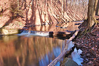
Fayl:Bělá v Pilském údolí, Boskovice, okres Blansko.jpg

Asl fayl (3 038 × 2 014 piksel, fayl hajmi: 3,19 MB, MIME tipi: image/jpeg)
Ushbu fayl Vikiomborga yuklangan boʻlib, boshqa loyihalarda ham qoʻllanilishi mumkin. Uning tavsif sahifasidan olingan maʼlumot quyida keltirilgan.
Qisqa izoh
| TaʼrifBělá v Pilském údolí, Boskovice, okres Blansko.jpg |
Čeština: Bělá v Pilském údolí, Boskovice, okres Blansko |
| Sanasi | |
| Manba | Oʻzimning ishim |
| Muallif | Jiří Komárek |
| Camera location | 49° 28′ 31,3″ N, 16° 38′ 45,92″ E | View this and other nearby images on: OpenStreetMap |
|---|
Litsenziyalash
- Siz erkinsiz:
- ulashishga – ishlanmani nusxalash, tarqatish va uzatish
- remiks qilishga – ishni moslashtirishga
- Quyidagi shartlar asosida:
- atribut – Siz tegishli litsenziyaga havolani taqdim etishingiz va oʻzgartirishlar kiritilganligini koʻrsatishingiz kerak. Siz buni har qanday oqilona yoʻl bilan qilishingiz mumkin, lekin litsenziar Sizni yoki Sizning foydalanishingizni ma'qullashini taklif qiladigan tarzda emas.
- bir xil ulashish – Agar Siz materialni remiks qilsangiz, oʻzgartirsangiz yoki unga asoslansangiz, oʻz hissalaringizni asl nusxadagi kabi bir xil yoki mos litsenziya ostida tarqatishingiz kerak.


In printed material: Photo: © Jiří Komárek, JiriKomarek.net, Licence: Creative Commons BY-SA 4.0 (URL: https://creativecommons.org/licenses/by/4.0/legalcode), Source: Wikimedia Commons

| This work is free and may be used by anyone for any purpose. If you wish to use this content, you do not need to request permission as long as you follow any licensing requirements mentioned on this page.
The Wikimedia Foundation has received an e-mail confirming that the copyright holder has approved publication under the terms mentioned on this page. This correspondence has been reviewed by a Volunteer Response Team (VRT) member and stored in our permission archive. The correspondence is available to trusted volunteers as ticket #2014050710009283. If you have questions about the archived correspondence, please use the VRT noticeboard.
Ticket link: https://ticket.wikimedia.org/otrs/index.pl?Action=AgentTicketZoom&TicketNumber=2014050710009283
|
Captions
Items portrayed in this file
tasvirlangan obyekt
some value
13 yanvar 2014
coordinates of the point of view inglizcha
49°28'31.300"N, 16°38'45.924"E
original creation by uploader inglizcha
image/jpeg
checksum inglizcha
526422d7a8e09fc795c4aa38d935ff874d16ce7b
data size inglizcha
3 344 430 Bayt
2 014 piksel
width inglizcha
3 038 piksel
captured with inglizcha
Nikon D40 inglizcha
exposure time inglizcha
8 soniya
f-number inglizcha
22
ISO speed inglizcha
200
focal length inglizcha
18 millimetr
Fayl tarixi
Faylning biror paytdagi holatini koʻrish uchun tegishli sana/vaqtga bosingiz.
| Sana/Vaqt | Miniatura | Oʻlchamlari | Foydalanuvchi | Izoh | |
|---|---|---|---|---|---|
| joriy | 17:07, 2014-yil 18-dekabr |  | 3 038 × 2 014 (3,19 MB) | Jiří Komárek | VicuñaUploader 1.20 |
Fayllarga ishoratlar
Bu faylga quyidagi sahifa bogʻlangan:
Faylning global foydalanilishi
Ushbu fayl quyidagi vikilarda ishlatilyapti:
- cs.wikipedia.org loyihasida foydalanilishi
- da.wikipedia.org loyihasida foydalanilishi
- en.wikipedia.org loyihasida foydalanilishi
- eo.wikipedia.org loyihasida foydalanilishi
- he.wikipedia.org loyihasida foydalanilishi
Metama’lumot
Bu fayl qoʻshimcha maʼlumotlarni oʻz ichiga oladi, ehtimol uni tuzish yoxud raqamlashtirish uchun raqamli kamera yoki skanerdan foydalanilgan.
Agar fayl asl holatidan oʻzgartirilgan boʻlsa, baʼzi tafsilotlar oʻzgartirilgan faylni toʻliq aks ettirmasligi mumkin.
| Camera manufacturer | NIKON CORPORATION |
|---|---|
| Camera model | NIKON D40 |
| Exposure time | 8/1 sec (8) |
| F Number | f/22 |
| ISO speed rating | 200 |
| Date and time of data generation | 12:35, 2014-yil 13-yanvar |
| Lens focal length | 18 mm |
| Latitude | 49° 28′ 31,36″ N |
| Longitude | 16° 38′ 46,14″ E |
| Altitude | 344,91 meters above sea level |
| Orientation | Normal |
| Software used | darktable 1.4.2 |
| File change date and time | 10:32, 2014-yil 6-dekabr |
| Pair of black and white reference values |
|
| Exposure Program | Manual |
| Date and time of digitizing | 12:35, 2014-yil 13-yanvar |
| APEX exposure bias | 0 |
| Maximum land aperture | 3,6 APEX (f/3,48) |
| Metering mode | Pattern |
| Light source | Fine weather |
| Flash | Flash did not fire |
| DateTime subseconds | 20 |
| DateTimeOriginal subseconds | 20 |
| DateTimeDigitized subseconds | 20 |
| Color space | sRGB |
| Sensing method | One-chip color area sensor |
| File source | Digital still camera |
| Scene type | A directly photographed image |
| Custom image processing | Normal process |
| Exposure mode | Manual exposure |
| White balance | Manual white balance |
| Digital zoom ratio | 1 |
| Focal length in 35 mm film | 27 mm |
| Scene capture type | Standard |
| Scene control | None |
| Contrast | Soft |
| Saturation | Normal |
| Sharpness | Normal |
| Subject distance range | Unknown |
| Measurement mode | 3-dimensional measurement |
| Geodetic survey data used | WGS-84 |
| GPS tag version | 2.0.0.0 |
| Rating (out of 5) | 1 |