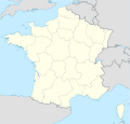
Fayl:France location map.svg

Size of this PNG preview of this SVG file: 626 × 600 piksel. Boshqa oʻlchamlari: 251 × 240 piksel | 501 × 480 piksel | 802 × 768 piksel | 1 069 × 1 024 piksel | 2 138 × 2 048 piksel | 1 041 × 997 piksel.
Asl fayl (SVG fayl, asl oʻlchamlari 1 041 × 997 piksel, fayl hajmi: 643 KB)
Fayl tarixi
Faylning biror paytdagi holatini koʻrish uchun tegishli sana/vaqtga bosingiz.
| Sana/Vaqt | Miniatura | Oʻlchamlari | Foydalanuvchi | Izoh | |
|---|---|---|---|---|---|
| joriy | 09:43, 2016-yil 2-yanvar |  | 1 041 × 997 (643 KB) | Superbenjamin | New borders |
| 12:33, 2012-yil 2-oktyabr |  | 1 041 × 997 (920 KB) | Palosirkka | Reverted to version as of 14:18, 7 July 2008 Location maps must remain very accurate | |
| 05:33, 2012-yil 2-oktyabr |  | 1 041 × 997 (566 KB) | Palosirkka | Scrubbed with http://codedread.com/scour/ | |
| 14:18, 2008-yil 7-iyul |  | 1 041 × 997 (920 KB) | NordNordWest | ||
| 18:05, 2008-yil 5-iyul |  | 1 041 × 997 (920 KB) | NordNordWest | corrected | |
| 19:14, 2008-yil 2-iyul |  | 1 041 × 997 (1,17 MB) | NordNordWest | ||
| 19:09, 2008-yil 2-iyul |  | 1 041 × 997 (1,17 MB) | NordNordWest | {{Information |Description= {{de|Positionskarte von Frankreich}} Quadratische Plattkarte, N-S-Streckung 140 %. Geographische Begrenzung der Karte: * N: 51.6° N * S: 41.0° N * W: 5.3° W * O: 10.2° O {{en|Location map of [[:en:France| |
Fayllarga ishoratlar
More than 100 pages use this file. The following list shows the first 100 pages that use this file only. A full list is available.
- Ambléon
- Ambronay
- Ambutrix
- Ambérieu-en-Bugey
- Ambérieux-en-Dombes
- Andert-et-Condon
- Anglefort
- Aranc
- Arbent
- Arbignieu
- Arbigny
- Ardes
- Armix
- Ars-sur-Formans
- Artemare
- Asnières-sur-Saône
- Attignat
- Baneins
- Beaupont
- Bellegarde-sur-Valserine
- Belley
- Belleydoux
- Bellignat
- Belmont-Luthézieu
- Bettant
- Beynost
- Billiat
- Birieux
- Biziat
- Blyes
- Bohas-Meyriat-Rignat
- Bolozon
- Bouligneux
- Bourg-Saint-Christophe
- Bourg-en-Bresse
- Boyeux-Saint-Jérôme
- Brech
- Briord
- Brégnier-Cordon
- Brénaz
- Brénod
- Buellas
- Bâgé-la-Ville
- Bâgé-le-Châtel
- Béligneux
- Bénonces
- Bény
- Béréziat
- Ceignes
- Certines
- Cessy
- Ceyzériat
- Ceyzérieu
- Chalamont
- Chaleins
- Chaley
- Challes-la-Montagne
- Challex
- Champagne-en-Valromey
- Champdor
- Champfromier
- Chanay
- Chaneins
- Chanoz-Châtenay
- Charix
- Charnoz-sur-Ain
- Chavannes-sur-Reyssouze
- Chavannes-sur-Suran
- Chaveyriat
- Chazey-Bons
- Chazey-sur-Ain
- Cheignieu-la-Balme
- Chevillard
- Château-Gaillard
- Châtillon-en-Michaille
- Châtillon-la-Palud
- Châtillon-sur-Chalaronne
- Chézery-Forens
- Civrieux
- Cleyzieu
- Coligny
- Colomieu
- Conand
- Condeissiat
- Confrançon
- Contrevoz
- Conzieu
- Corbonod
- Corlier
- Cormaranche-en-Bugey
- Cormoranche-sur-Saône
- Hesse
- Lizio
- Molsheim
- Motz
- Parij
- Prat
- Rosel
- Sens
- Taden
View more links to this file.
Faylning global foydalanilishi
Ushbu fayl quyidagi vikilarda ishlatilyapti:
- av.wikipedia.org loyihasida foydalanilishi
- ba.wikipedia.org loyihasida foydalanilishi
- bn.wikipedia.org loyihasida foydalanilishi
- ceb.wikipedia.org loyihasida foydalanilishi
- Beaulieu
- Beaumont
- Saint-Léger
- Entraigues-sur-la-Sorgue
- Orange
- Villenave-d'Ornon
- Osse-en-Aspe
- Les Eyzies-de-Tayac-Sireuil
- Quincerot, Côte-d'Or
- Courcelles
- Loguivy-Plougras
- Saint-Erblon, Ille-et-Vilaine
- Locmalo
- Chémery-sur-Bar
- Bourgogne (pagklaro)
- Ferrières
- Beaufort
- Montricher-Albanne
- Bonne
- Montendre
- Cauterets
- Castelmaurou
- Naives-Rosières
- Merlines
- Guémené-Penfao
- Gesté
- Belleau
- Lavalette
- La Chapelle
- Barby
- Gourdon
- Rouvroy
- Remicourt
- Rochefort
- Sainte-Foy, Saône-et-Loire
- Bray
- Villefranche
- Roche
Ushbu faylni koʻproq global foydalanishdan koʻring.

