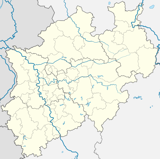
Fayl:North Rhine-Westphalia location map 01.svg

Size of this PNG preview of this SVG file: 527 × 524 piksel. Boshqa oʻlchamlari: 241 × 240 piksel | 483 × 480 piksel | 772 × 768 piksel | 1 030 × 1 024 piksel | 2 060 × 2 048 piksel.
Asl fayl (SVG fayl, asl oʻlchamlari 527 × 524 piksel, fayl hajmi: 1,22 MB)
Fayl tarixi
Faylning biror paytdagi holatini koʻrish uchun tegishli sana/vaqtga bosingiz.
| Sana/Vaqt | Miniatura | Oʻlchamlari | Foydalanuvchi | Izoh | |
|---|---|---|---|---|---|
| joriy | 19:35, 2009-yil 16-dekabr |  | 527 × 524 (1,22 MB) | TUBS | korr crop area |
| 09:05, 2009-yil 20-oktyabr |  | 657 × 656 (476 KB) | TUBS | -ac | |
| 20:33, 2009-yil 26-yanvar |  | 657 × 656 (479 KB) | TUBS | {{Information |Description= |Source= |Date= |Author= |Permission= |other_versions= }} | |
| 20:26, 2009-yil 26-yanvar |  | 657 × 656 (479 KB) | TUBS | {{Information |Description= |Source= |Date= |Author= |Permission= |other_versions= }} | |
| 08:23, 2008-yil 4-noyabr |  | 657 × 656 (429 KB) | TUBS | {{Information |Description= |Source= |Date= |Author= |Permission= |other_versions= }} | |
| 08:40, 2008-yil 9-oktyabr |  | 657 × 656 (424 KB) | TUBS | {{Information |Description= |Source= |Date= |Author= |Permission= |other_versions= }} | |
| 08:38, 2008-yil 9-oktyabr |  | 688 × 688 (424 KB) | TUBS | {{Information |Description= |Source= |Date= |Author= |Permission= |other_versions= }} | |
| 08:44, 2008-yil 8-oktyabr |  | 654 × 656 (424 KB) | TUBS | *reduced stroke thickness again (rivers and districts) | |
| 08:27, 2008-yil 8-oktyabr |  | 654 × 656 (424 KB) | TUBS | *lightened district borders | |
| 08:09, 2008-yil 8-oktyabr |  | 654 × 656 (424 KB) | TUBS | *added transpareny to all those above-rivers-lines *moved the rivers aside the borders |
Fayllarga ishoratlar
Bu faylga quyidagi 5 sahifalar bogʻlangan:
Faylning global foydalanilishi
Ushbu fayl quyidagi vikilarda ishlatilyapti:
- als.wikipedia.org loyihasida foydalanilishi
- ar.wikipedia.org loyihasida foydalanilishi
- azb.wikipedia.org loyihasida foydalanilishi
- az.wikipedia.org loyihasida foydalanilishi
- Vuppertal
- Şablon:Yer xəritəsi Almaniya Şimali Reyn-Vestfaliya
- Kosfeld
- Hagen
- Hamm
- Mönxenqladbax
- Mülhaym
- Münster
- Remşayd
- Herne (Şimali Reyn-Vestfaliya)
- Drenştaynfurt
- İsselburq
- Ştaynfurt
- Varendorf
- Zassenberq
- Zendenhorst
- Hayligenhaus
- Ratingen
- Verl
- Datteln
- Emsdetten
- Or-Erkenşvik
- Rede
- Telqte
- Teklenburq
- Velen
- Villix
- Ziqen
- UEFA Avropa Liqası 2019/2020
- ba.wikipedia.org loyihasida foydalanilishi
- bg.wikipedia.org loyihasida foydalanilishi
- bn.wikipedia.org loyihasida foydalanilishi
- ceb.wikipedia.org loyihasida foydalanilishi
- cs.wikipedia.org loyihasida foydalanilishi
- cv.wikipedia.org loyihasida foydalanilishi
Ushbu faylni koʻproq global foydalanishdan koʻring.


