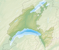
Fayl:Reliefkarte Waadt blank.png

Bu prevyuning hajmi: 711 × 600 piksel. Boshqa oʻlchamlari: 285 × 240 piksel | 569 × 480 piksel | 911 × 768 piksel | 1 214 × 1 024 piksel | 2 429 × 2 048 piksel | 3 733 × 3 148 piksel.
Asl fayl (3 733 × 3 148 piksel, fayl hajmi: 6,6 MB, MIME tipi: image/png)
Fayl tarixi
Faylning biror paytdagi holatini koʻrish uchun tegishli sana/vaqtga bosingiz.
| Sana/Vaqt | Miniatura | Oʻlchamlari | Foydalanuvchi | Izoh | |
|---|---|---|---|---|---|
| joriy | 17:04, 2021-yil 26-dekabr |  | 3 733 × 3 148 (6,6 MB) | Tschubby | {{Information |Description= |Source= |Date= |Author= |Permission= |other_versions= }} |
| 12:03, 2013-yil 6-dekabr |  | 3 111 × 2 627 (7,38 MB) | Tschubby | {{Information |Description= {{de| Reliefkarte des Kantons Waadt}} Topographischer Hintergrund: [http://www2.jpl.nasa.gov/srtm NASA Shuttle Radar Topography Mission] (public domain). SRTM3 v.2. |Source={{own}} |Date= 2013-12-06 |Author= [[:de:User:Tschu... |
Fayllarga ishoratlar
Bu faylga quyidagi 3 sahifalar bogʻlangan:
Faylning global foydalanilishi
Ushbu fayl quyidagi vikilarda ishlatilyapti:
- bh.wikipedia.org loyihasida foydalanilishi
- de.wikipedia.org loyihasida foydalanilishi
- Schloss Chillon
- Chasseron
- La Dôle
- Mont Tendre
- Lac de Joux
- Lac Brenet
- Orbe (Fluss)
- Risoux
- Talent (Fluss)
- Col des Mosses
- Lac de l’Hongrin
- Col du Marchairuz
- Col de l’Aiguillon
- Col du Pillon
- Col du Mollendruz
- Col de la Givrine
- Col des Étroits
- Tour d’Aï
- HBG (Zeitzeichensender)
- Rochers de Naye
- Landessender Sottens
- Les Agites
- Mentue
- Petite Glâne
- Lembe (Fluss)
- Veyron (Fluss)
- Buron (Neuenburgersee)
- Sauteru
- Lac de Bret
- Mont Pèlerin
- Chandon (Fluss)
- Mormont (Berg)
- Dent de Vaulion
- Aiguilles de Baulmes
- Suchet (Berg)
- Mont Aubert
- Liste von Burgen und Schlössern in der Schweiz
- Noirmont (Berg)
- Crêt de la Neuve
- Les Pléiades
- Arrissoules-Tunnel
- Pomy-Tunnel
- Sender La Dôle
- Schloss Prangins
Ushbu faylni koʻproq global foydalanishdan koʻring.

