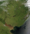
Fayl:Uruguay T2.png

Bu prevyuning hajmi: 527 × 599 piksel. Boshqa oʻlchamlari: 211 × 240 piksel | 422 × 480 piksel | 691 × 786 piksel.
Asl fayl (691 × 786 piksel, fayl hajmi: 1,18 MB, MIME tipi: image/png)
Fayl tarixi
Faylning biror paytdagi holatini koʻrish uchun tegishli sana/vaqtga bosingiz.
| Sana/Vaqt | Miniatura | Oʻlchamlari | Foydalanuvchi | Izoh | |
|---|---|---|---|---|---|
| joriy | 04:11, 2004-yil 29-noyabr |  | 691 × 786 (1,18 MB) | Tano4595 | Uruguay_satelite |
Fayllarga ishoratlar
Bu faylga quyidagi sahifa bogʻlangan:
Faylning global foydalanilishi
Ushbu fayl quyidagi vikilarda ishlatilyapti:
- af.wikipedia.org loyihasida foydalanilishi
- als.wikipedia.org loyihasida foydalanilishi
- an.wikipedia.org loyihasida foydalanilishi
- ar.wikipedia.org loyihasida foydalanilishi
- ast.wikipedia.org loyihasida foydalanilishi
- azb.wikipedia.org loyihasida foydalanilishi
- ba.wikipedia.org loyihasida foydalanilishi
- bg.wikipedia.org loyihasida foydalanilishi
- ca.wikipedia.org loyihasida foydalanilishi
- cs.wikipedia.org loyihasida foydalanilishi
- da.wikipedia.org loyihasida foydalanilishi
- de.wikipedia.org loyihasida foydalanilishi
- el.wikipedia.org loyihasida foydalanilishi
- en.wikipedia.org loyihasida foydalanilishi
- en.wikibooks.org loyihasida foydalanilishi
- eo.wikipedia.org loyihasida foydalanilishi
- es.wikipedia.org loyihasida foydalanilishi
- eu.wikipedia.org loyihasida foydalanilishi
- fr.wikipedia.org loyihasida foydalanilishi
- gcr.wikipedia.org loyihasida foydalanilishi
- hi.wikipedia.org loyihasida foydalanilishi
- hr.wikipedia.org loyihasida foydalanilishi
- hu.wikipedia.org loyihasida foydalanilishi
- hy.wikipedia.org loyihasida foydalanilishi
- hyw.wikipedia.org loyihasida foydalanilishi
- is.wikipedia.org loyihasida foydalanilishi
- it.wikipedia.org loyihasida foydalanilishi
- ku.wikipedia.org loyihasida foydalanilishi
- la.wikipedia.org loyihasida foydalanilishi
- li.wikipedia.org loyihasida foydalanilishi
- lv.wikipedia.org loyihasida foydalanilishi
- ms.wikipedia.org loyihasida foydalanilishi
- mt.wikipedia.org loyihasida foydalanilishi
- oc.wikipedia.org loyihasida foydalanilishi
- os.wikipedia.org loyihasida foydalanilishi
- pcd.wikipedia.org loyihasida foydalanilishi
Ushbu faylni koʻproq global foydalanishdan koʻring.

