Modul:Module:Location map/data/Japan Akita Akita/doc
Bu sahifa Modul:Module:Location map/data/Japan Akita Akita uchun hujjat sahifasidir
| Bu moduldan 4+ sahifada foydalanilgan. Tajriba oʻtkazish uchun modulning /qumloq yoki /test ostsahifalaridan foydalaning. Oʻzgarishlar kiritishdan avval boshqa foydalanuvchilar bilan muhokama qilish haqida oʻylab koʻring. |
| name | Japan | ||
|---|---|---|---|
| x | 100*(($1>30.90)*($2-128.24)/(149.27-128.24)+($1<=30.90)*($2-110.43)/(131.44-110.43)) | ||
| y | 100*(($1>30.90)*($1-45.86)/(30.02-45.86)+($1<=30.90)*($1-39.54)/(23.71-39.54)) | ||
| image | Japan location map with side map of the Ryukyu Islands.svg
| ||

| |||
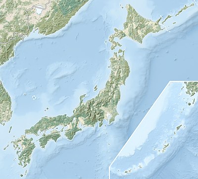
| image1 | Japan natural location map with side map of the Ryukyu Islands.jpg
| ||

| |||
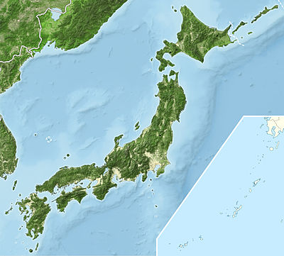
| image2 | Japan bluemarble location map with side map of the Ryukyu Islands.jpg
| ||

| |||

Modul:Module:Location map/data/Japan Akita Akita joylashuv xaritasi taʼrifi boʻlib, an equirectangular projection Akita, Akitadagi markerlar va yorliqlarni joylashtirish uchun foydalaniladi. :Modul:Module:Location map/data/Japan Akita Akita/doc|1|3}}|ism}}]]}}}. Markerlar standart xaritada yoki shunga o'xshash xarita tasvirida kenglik va uzunlik koordinatalari bo'yicha joylashtiriladi.
Qoʻllanilishi
Ushbu ta'riflar parametr bilan chaqirilganda quyidagi andozalar tomonidan qo'llaniladi „Japan Akita Akita“:
{{Location map | Japan Akita Akita | …}}{{Location map many | Japan Akita Akita | …}}{{Location map+ | Japan Akita Akita | …}}{{Location map~ | Japan Akita Akita | …}}
Xarita tavsifi
name = Akita, Akita- Standart xarita sarlavhasida foydalanilgan ism
image = Akita, Akita, Japan.png- Standart xarita tasviri, “Rasm:” yoki “Fayl:”siz
top = 39.7285- Latitude at top edge of map, in decimal degrees
bottom = 39.7104- Latitude at bottom edge of map, in decimal degrees
left = 140.0754- Longitude at left edge of map, in decimal degrees
right = 140.122987- Longitude at right edge of map, in decimal degrees
Precision
Longitude: from West to East this map definition covers Expression error: Unrecognized punctuation character " ". degrees.
- At an image width of 200 pixels, that is Expression error: Unrecognized punctuation character " ". degrees per pixel.
- At an image width of 1000 pixels, that is Expression error: Unrecognized punctuation character " ". degrees per pixel.
Latitude: from North to South this map definition covers Expression error: Unrecognized punctuation character " ". degrees.
- At an image height of 200 pixels, that is Expression error: Unrecognized punctuation character " ". degrees per pixel.
- At an image height of 1000 pixels, that is Expression error: Unrecognized punctuation character " ". degrees per pixel.
Xaritalar joylashuvi andozalariga misollar
Location map, using default map (image)
Lua xatosi in Modul:Location_map at line 522: Unable to find the specified location map definition: "Module:Location map/data/Japan" does not exist.
{{Location map |Japan
|label = Fukuoka
|coordinates = {{coord|33|35|N|130|24|E|display=inline}}
}}
Location map many, using relief map (image1)
Lua xatosi in Modul:Location_map/multi at line 143: Unable to find the specified location map definition: "Module:Location map/data/Japan" does not exist.
{{Location map many |Japan
|relief = yes
|caption = Locations in [[Japan]] and [[Ryukyu Islands]]
|background = lightgrey
|label1 = Fukuoka
|coordinates1 = {{coord|33|35|N|130|24|E|display=inline}}
|label2 = Naha
|coordinates2 = {{coord|26|12|N|127|41|E|display=inline}}
}}
Location map+, using AlternativeMap
Lua xatosi in Modul:Location_map/multi at line 27: Unable to find the specified location map definition: "Module:Location map/data/Japan" does not exist.
{{Location map+ |Japan
|AlternativeMap = Japan bluemarble location map with
                  side map of the Ryukyu Islands.jpg
|caption = Locations in [[Japan]] and [[Ryukyu Islands]]
|places =
  {{Location map~ |Japan
  |background = lightgrey
  |label = Fukuoka
  |coordinates = {{coord|33|35|N|130|24|E|display=inline}}
  }}
  {{Location map~ |Japan
  |label = Naha
  |coordinates = {{coord|26|12|N|127|41|E|display=inline}}
  }}
}}
Examples using Infobox settlement
Main islands north of 30.90°N, with default map image
Fukuoka | |
|---|---|
{{{type}}} | |
| Lua xatosi in Modul:Location_map at line 522: Unable to find the specified location map definition: "Module:Location map/data/Japan" does not exist. | |
| Koordinatalari: 33°35′N 130°24′E / 33.583°N 130.400°E | |
| Country | Japan |
| Region | Kyūshū |
| Prefecture | Fukuoka |
{{Infobox settlement
|name               = Fukuoka
|subdivision_type   = Country
|subdivision_name   = Japan
|subdivision_type1  = Region
|subdivision_name1  = Kyūshū
|subdivision_type2  = Prefecture
|subdivision_name2  = Fukuoka
|pushpin_map        = Japan
|coordinates        = {{coord|33|35|N|130|24|E|region:JP|display=inline}}
}}
Ryukyu Islands south of 30.90°N, with alternative map image
Naha | |
|---|---|
{{{type}}} | |
| Lua xatosi in Modul:Location_map at line 522: Unable to find the specified location map definition: "Module:Location map/data/Japan" does not exist. | |
| Koordinatalari: 26°12′N 127°41′E / 26.200°N 127.683°E | |
| Country | Japan |
| Region | Kyūshū |
| Prefecture | Okinawa |
{{Infobox settlement
|name               = Naha
|subdivision_type   = Country
|subdivision_name   = [[Japan]]
|subdivision_type1  = Region
|subdivision_name1  = Kyūshū
|subdivision_type2  = Prefecture
|subdivision_name2  = Okinawa
|pushpin_map        = Japan
|pushpin_image      = Japan natural location map with
                      side map of the Ryukyu Islands.jpg
|coordinates        = {{coord|26|12|N|127|41|E|region:JP|display=inline}}
}}
Yana qarang
Xaritalar joylashuvi andozalari
- Template:Location map, to display one mark and label using latitude and longitude
- Template:Location map many, to display up to nine marks and labels
- Template:Location map+, to display an unlimited number of marks and labels